Programming & Analytics
 Seaborn
 PySpark
Data Scientist | MSc Data Science | MSc Petroleum Geology | Python • ML • DL • TensorFlow • PySpark • SQL
Technical skills aligned with applied data science, geospatial analytics, and scalable analytical workflows.
Seaborn
PySpark
 ArcGIS Online
Microsoft Azure (Administrator Certified)
 Tableau
 ArcGIS Pro
 ArcGIS Enterprise
 ArcGIS Dashboards
 ArcGIS Experience Builder
 ArcGIS Insights
 FME Form

Benchmarking classical machine learning models for multi-class classification of low-magnitude seismic events (M1–4) using USGS catalogue data under severe class imbalance.
View Project →
PySpark and Tableau analysis identifying the strongest predictors of vehicle CO₂ emissions in Canada (1995–2023), using scalable Spark ML pipelines.
View Project →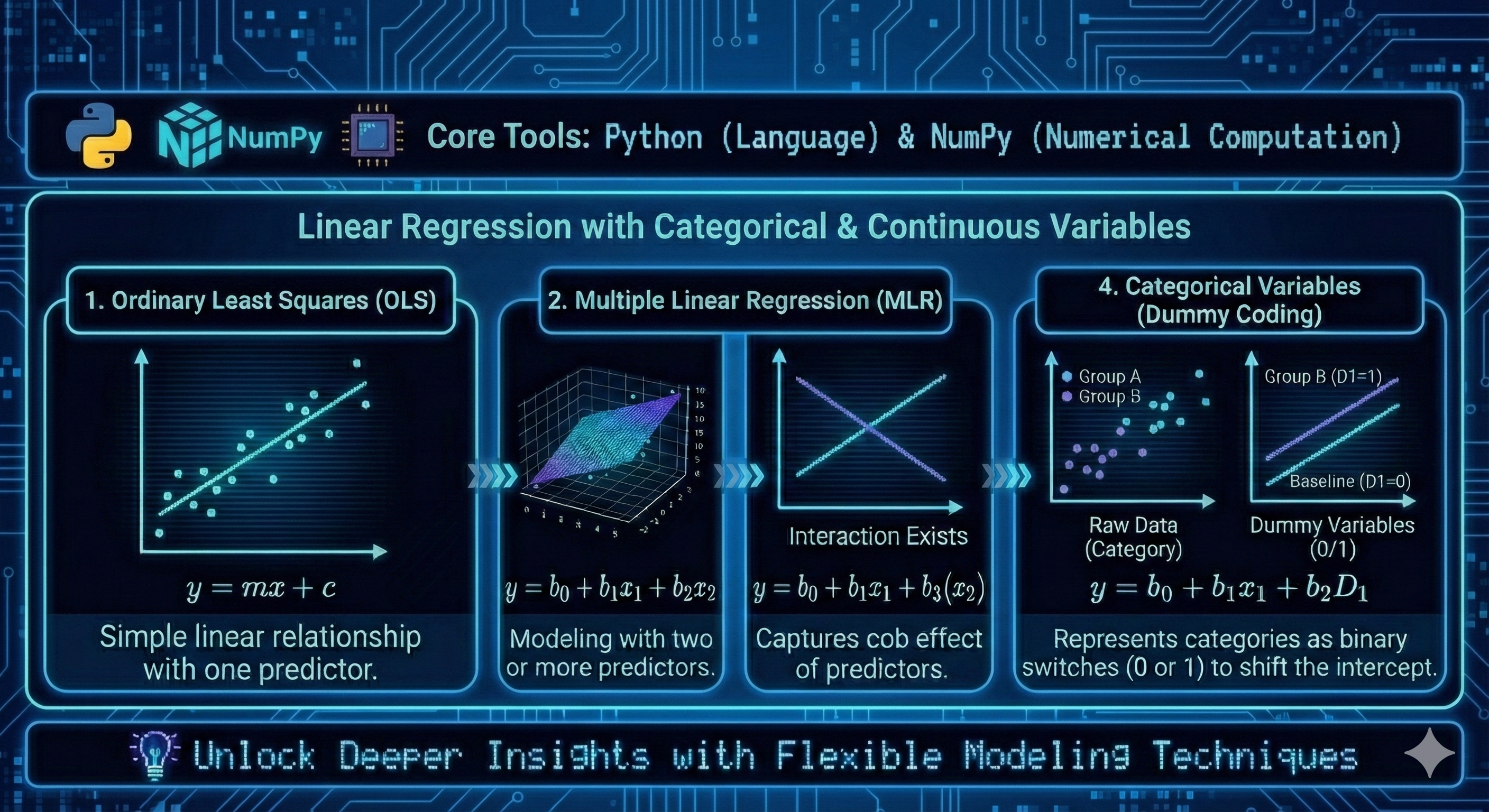
Matrix-based Ordinary Least Squares implementation from first principles, demonstrating explicit linear algebra, dummy variables, and interaction effects.
View Project →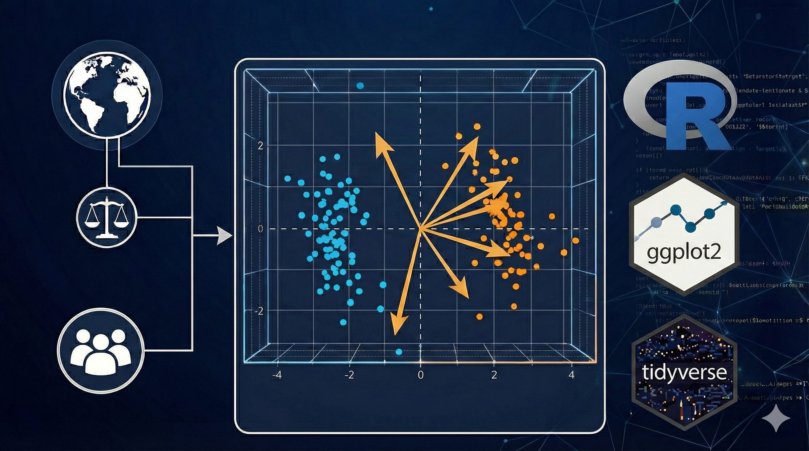
Principal Component Analysis of the Global Life–Work Balance Index, revealing global and Europe-only structures with policy and healthcare insights.
View Project →
Console-based Blackjack game implementing deck simulation, scoring rules, Ace handling, and rule-based dealer logic.
View Project → Microsoft Certified: Azure Fundamentals
 Microsoft Certified: Azure Administrator Associate
 IBM Data Science Professional Certificate
 IBM Data Analyst Professional Certificate
 Geographic Information Systems (GIS)
Integrated spaceborne optical remote sensing with field investigations to map structural lineaments and tectonic features of the Kharit interior rift basin, Southeastern Desert, Egypt.
View Publication →Remote sensing–based analysis of igneous activity surrounding the Kharit Basin, highlighting magmatic structures and tectonic controls using satellite imagery and geospatial interpretation.
View Publication →